Our journey is broken into three days. First we travel from UCSB to LAX, and from LAX to Doha, Qatar via a 19 hour flight on Qatar Airways.
My first impression was clouded by having a seat completely soaked by a miscellaneous fluid, a fluid that quickly absorbed itself into my pants. But then we realized that we were going to have whole rows completely to ourselves. I moved to the window, tucked myself in among my supply of pillows and blankets, and was ready for the long haul. Then a flight attendant brought a freshette towel, headphones, and mini toiletry pouch (with an impossibly adorable tiny toothbrush and toothpaste) to aid our journey’s comfort. I discovered quickly we had access to a wide range of interesting movies and television shows for in-flight entertainment. We were served a reasonly delicious supper not long after reaching altitude, a mere 42,000 feet. Much of the flight was a movie marathon between regular offerings of water or juice by the flight attendants. They all seemed so calm and happy to make us comfortable. There was a snack time in there for those awake during the night, for which I was of course binging into my fourth film by then. And toward morning, we received an assorted meal somewhere between breakfast and lunch. My favorite part was that every meal included dessert and ended with a round of tea with milk.
Qatar Airways is advertised as a luxury airline, and Hamad International Airport aims to become the highest rated airport. Our second day ended with a package deal to stay overnight in Doha. We had a 15 hour layover, with no option for an earlier flight, so took the Qatar Airways bargain to get out of the airport a bit. They arranged the entrance Visa, hotel with shuttle, supper voucher, and luggage transfer for an arguably small price of $125.
We stayed at the Oryx Rotana Doha hotel. It is a super modern hotel with several restaurants, including hookah bar and live jazz. We ate at The Cellar for a two course meal with unlimited wine. Unfortunately customs took a long time and then we walked out right as a shuttle left, requiring an additional wait for the next one. Resulting in us having no real amount of time to actually go out and see much of Doha. By the time we ate and showered, I was well past my bedtime. Melissa stepped out a minute for a phone call home and by the time she returned, I had peacefully closed my eyes while propped up in front of the television, wearing a cozy bathrobe. Melissa said I looked like a model for a spa advertisement. At some point I finished crawling the rest of the way into bed. It was an amazing night’s sleep.
Today sort of snuck up on me. Since returning from winter break I felt like I had spent every waking moment in the lab. Barely sleeping, barely going home to change clothes. Then across a few short days my mass spectrometer analyses were finished and a new week began. That was this week, and it brought its own sense of hurry as I scurried to organize and pack for a long departure. And just like that, Melissa and I are sitting on a plane, shooting through the sky toward Tanzania.
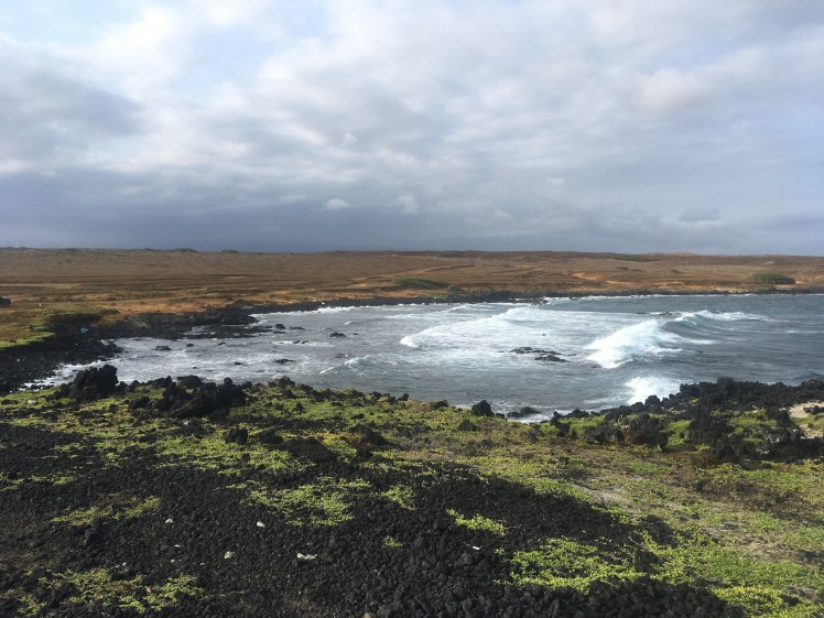
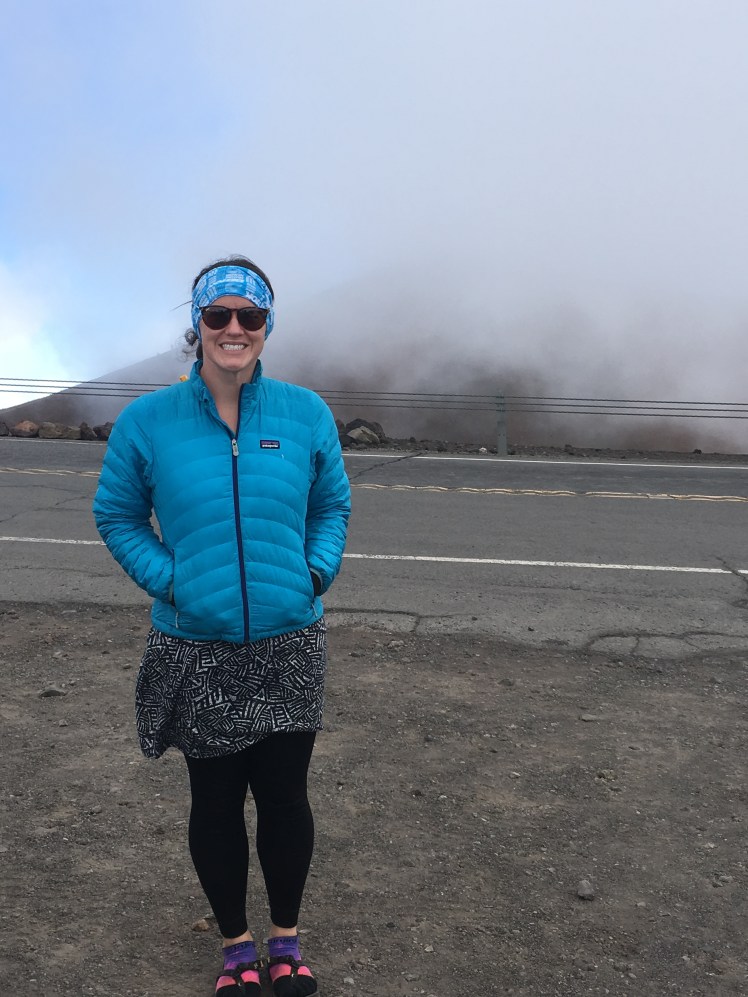
We all woke early, during a brief spurt of sunshine and packed up camp. Then the rain started. We were planning the crater chain hike, but motivation was low. When we arrived, our interest dropped to zero upon discovering the trail required backcountry permit. We decided to wander aimlessly around the park instead, stopping at many of the less advertised stops.
I found it curios how the trails are setup on this island. I do not fully understand the draw to certain areas. Numerous trails led you to exposed lava rock, with no water, that would be radiating heat when sunny and completely lifeless without sun, and no grand vistas. Strange trails. Not that I am against hiking for hiking’s sake. But these trails are well established routes. I suppose my spoiled mainland life leaves me looking down on building trails where space is available instead of building trails where interesting nature happens. It would be incredibly challenging to live in a place where a year of weekend adventures could completely exhaust all hiking avenues. As a visitor it is fantastic, but as a resident, I would find these islands to eventually feel too small. I have always been a wanderer though.
We stopped at Mauna Ulu. I purchased a trail guide and regaled the group with its super neat back-history. Namely, the pamphlet detailed the timing, quantity, close call of life, changes to landscape, and lava tree formation of Mauna Ulu’s eruption between 1969-1974. It produced over 350 million cubic meters of lava! The flows covered approximately 44 square kilometers, and in some places the lava pooled almost 8 meters deep. Like the flickering of a flame, lava is even more tantalizing. I read once that in cultures where fire is used regularly as a tool, people generally stop revering fire once they have mastered how to create, maintain, and extinguish a flame, about the age of seven. But I don’t know if I completely agree, because I know how to do those things, and yet I find fire to be mesmerizing. And lava even more so. Maybe I need to gain a higher level of understanding about large fires to satiate that curiosity.
We also stopped at Devastation Trail. This path leads through a still recovering dense rain forest to the 1959 eruption site of Kilauea Iki crater in 1959. A fissure eruption that produced towering lava fountains, reaching almost 500 meters into the sky. Remnants remain today of Pele’s hair and Pele’s tears formed from the spurting lava. Today it was a cold and soggy cloud enclosed tunnel of trees.
Having exhausted the remaining places to visit, we headed for the visitor center and our final exit. The power was back and I wandered through the gift shop, collecting mementos. What a worthy place to visit. We even saw three nene while driving this morning. No photos, but every time I saw this Hawaiian native goose, I kept singing “now watch me whip, whip, now watch me nene.”
We drove back to Hilo, the rain continuing the rest of the day, clouds blanketing our views. We took one last jaunt through town, eating lunch at the boochery. I had a delectable roasted veggie sandwich on sourdough, with sweet potato salad, and beet booch mixed with super ginger tonic booch. Yum!
It seemed like every shop and store were closed from the weather. Everyone taking the day to curl up with a hot drink and book. Really it was just a Sunday, and Hilo seems to close down that day. Luckily the coffee shop was open, so we went for a second round of ice cream. I also bought a breakfast cookie! So excited! The ingredients are like my own dense cookie pucks. We waited out the rain a little while with a crossword. We pretty much killed it with four brains at work.
My sister and I dropped Libby and Jack off for their flight. They were able to catch an earlier flight. It was fantastic seeing them! We tried to give them all our leftover food and snacks to take home. I hope to visit again soon to continue exploring the other islands. Erika and I continued our drive. We thought we could gain some ground to shorten the remaining distance tomorrow. Our hope was to explore Kona a bit more.
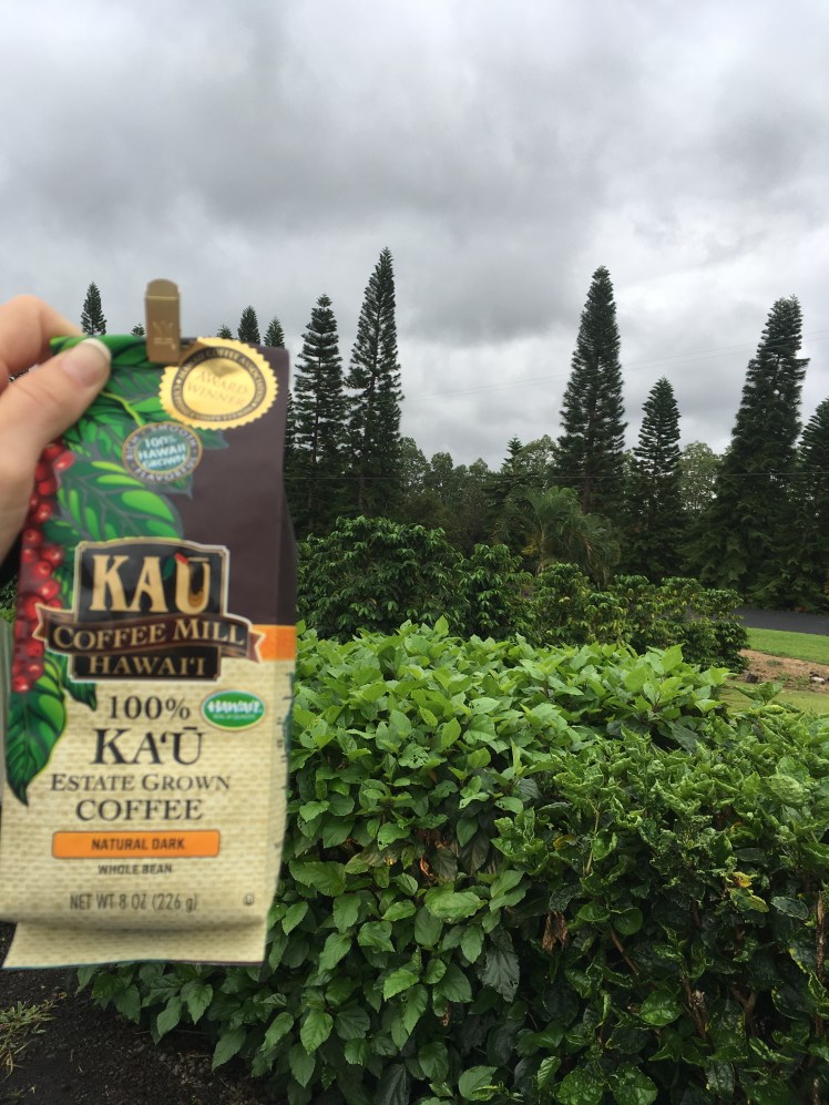
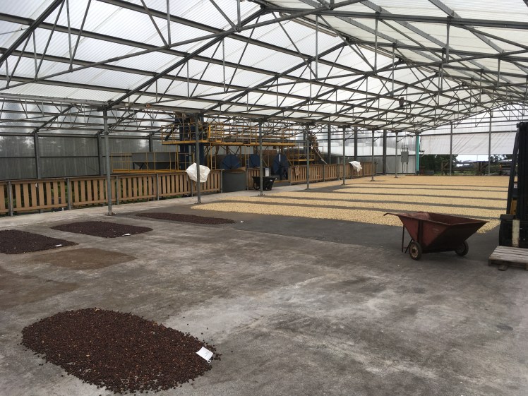
We took several side trips. A highlight was the Ka’u coffee plantation. I learned that macadamia nuts were once named “donkey balls” by earlier voyageurs when they visited the islands. They let us explore the coffee drying area. They also claim to be the oldest plantation on Hawai’i island. I found it difficult to fact check that information. I am not much of a coffee drinker. Honestly it makes me feel anxious and sweaty. But they had samples out of all the different bean types and roasting options. It was pretty neat to actually try a variety and compare the flavors. I even felt motivated to buy my favorite flavor as a gift. Hopefully my untrained taste buds serve me well! The best part was samples of macadamia nut brittle! Delicious! This was a neat side trip.
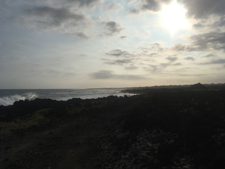
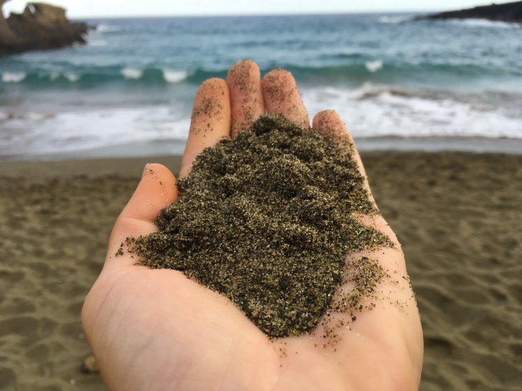
The best side excursion was to Papakolea Beach, or the Green Sand Beach. It turned out to be a much longer distance than we had realized, both for the drive and the hike out. It was actually pretty eerie as we drove out. First we drove through a couple small communities, then the drive continues on this small paved road toward nothing, and you drive on that road for quite awhile with nothing around except pastureland. At the very end of South Point Road we turned into a sketchy parking area with just as many broken down and abandoned vehicles as seemingly not broken down vehicles. There were foundations of all these buildings that didn’t exist. Everything looked abandoned. Just a lone corner of the island at the end of an empty road, everything dusty and broken down. The perfect setting for every horror movie you have ever seen. There were just enough signs of life that we kept going, not really knowing where we were going or how far it was to get there. We parked and started walking. It turned out to only be about 3 miles out on a rugged path heavily abused by off-road vehicles. The erosion of the volcanic ash created a super fine powder that completely caked our legs. And we could see a storm coming in as we began the hike out. At first we stayed on the path closest to the coast and watched raging ocean waves crash against the jagged basalt. It was a peak at the raw coastlines we had not seen on the islands yet. There was an overwhelming abundance of sea debris: propeller blades, metal trap cages, fish netting, bottles, drift wood, everything. It was filthy. It is what the beaches would actually look like if the tourist areas weren’t maintained, collecting all the waste dumped into the ocean. This was more visceral and disgusting than any exhibit I have ever seen to bring awareness to ocean littering. I will leave this article if you want to read more about the problem of plastics in our oceans. Anyway, this is clearly a local hangout. So many beefed-up off-road vehicles were driving around and parked by the ocean, one of the few signs that this place isn’t really abandoned. We could see the olivine content increasing in the small sand pockets as we neared the beach, but I was not prepared for how amazing this was going to be. A whole beach composed almost entirely of olivine grains eroding out of the partially collapsed volcanic tuff ring. This is one of four beaches in the world with sand made almost entirely of olivine! Olivine is one of the first minerals to form as magma cools, and is common in Hawaiian volcanoes. The beach is mostly olivine because this ferrous iron (hence green) mineral is denser than the volcanic ash, which is washed out to sea. The surrounding rock is relatively stable, so the layers are preserving previous eruptions and lava flows. We climbed down these layers to the beach below. It was magnificent! I know my sister enjoyed it, how could she not, but I sorted of lost my mind at first geeking out over how spectacular this was. I remember pacing around the beach, checking the sand for the highest olivine abundance, and scurrying across the rocks to look at where the grains were eroding out from. I was geeking hard for geology. I am constantly reminded how I study the neatest science. After collecting myself, we hurried back to beat the encroaching storm and quickly fading light. We were rewarded with a beautiful sunset over of the pasture. We had to wash off in the ocean before getting back into the vehicle. We were both covered in thick, orange layers of volcanic ash. I cannot imagine driving over that slick powdery surface in the trailer vehicles that were giving people rides.
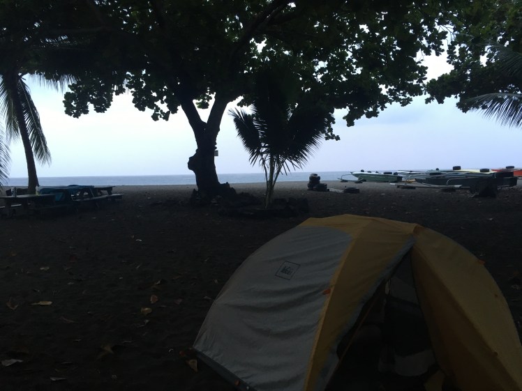
It was a dark drive back to the main road. We did not have a plan for where we would be able to camp. Somehow we were able to get in at a beach camp that must be mostly predominantly favored by locals. The night guard was surprised when we pulled out California ID’s after announcing our non-local status, which unfortunately resulted in a different camp cost, which we literally had to count out coins to come up with. Of course we didn’t have any more cash on the last night of our trip, haha! We set up the tent and snuck off for stealth showers at the outdoor beach area. It was scandalous but so worth it. There were feral cats, cockroaches, flat box bugs, ants, palm nuts falling all around us, and ten feet from pounding ocean. I think we both slept like babies. Our final night’s rest at the end of an incredible trip. Aloha Hawai’i, until next time.
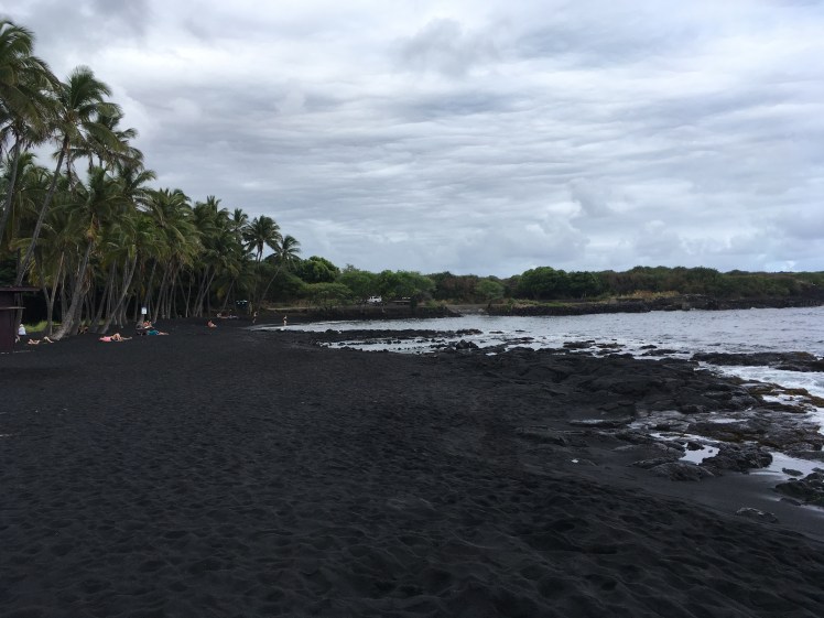
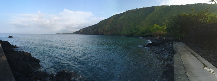
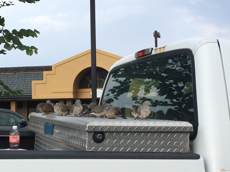
Ka’u estate grown coffee. There were macadamia nut trees for miles!Coffee bean workshop at Ka’u Coffee.Black sand beach! Sand made of crumbled bits of basalt.This coastline was starkly different than the more touristy areas. Big crashing waves on jagged basalt with heaps and heaps of sea debris littered all along the coast. Fish nets, propellers, buoys, plastic bottles, metal traps, and so much more. Protect the ocean from trash, it’s important to the longevity of Earth’s largest ecosystems.Incredible southern coast.Olivine sand beach!Green sand! It’s completely full of olivine!Sunset over the pasture land.Our last beach campsite.Captain Cook bayFunny birds chilling on this truck and no where else in the parking lot.
For more photos you can follow me on Instagram @schemesinmotion
Double summit: Mauna Loa, largest mountain on Earth, and Mauna Kea, highest point on Hawai’i.
9/7/2017
Hiking up yesterday took longer than we thought, so we did not reach the summit proper until this morning. Mauna Loa, largest mountain in world. Bigger than Everest! The volcano begins at the ocean bottom and rises to 13,679 feet (7,079 ft prominence). We traversed 5 miles around crater rim to reach the summit proper. Definitely worth the effort! By far one of the neatest accomplishments I have pursued. I was on top of the world, and felt like I was transported to Mars. What a crazy crazy terrain.
After reveling in the moment, we left the summit and hiked back down to vehicle parked at the observatory. We hiked 6.2 miles up 2,291 feet of gain to the summit cabin and 11.6 miles today (which still had 762 feet of gain, despite climbing down). Fortunately, I learned from the mistakes of Waimanu Valley and brought my phone battery to map our route!
On the return route we had better views of the more recent lava flows and a view over the Mauna Loa Observatory. Once back to the vehicle we drove back down the winding lava road, crossed the highway, then drove straight up the side of Mauna Kea.
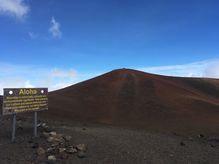
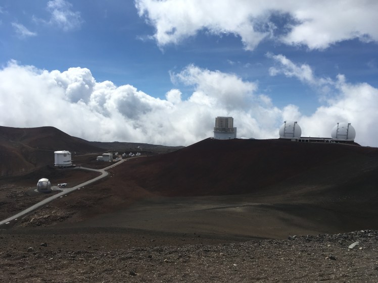
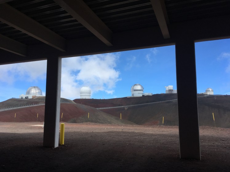
Mauna Kea is the highest peak on Hawai’i (and the Big Island, obviously). We drove almost to that highest point. Mauna Kea is the location of 13 (soon to be 14) giant telescopes. So there is a paved road all the way to the top, except for an odd four miles right after the visitor center, which seems quite odd.
The true summit is 13,803 feet. Due to cultural and historical significances, we did not finish hiking to the summit. Others may violate that request, but I feel morally ok in claiming the Hawaii high point by standing just off from the true summit. Almost instantly after reaching the top we were enveloped in clouds. And while up there we drove to Keck Observatory but didn’t go in. So many telescopes!
It was barely after lunch and we had completed both volcano summits. Afterward we drove to Hilo and checked in at Arnott’s Lodge (seriously a hiker haven if I have ever experienced one!). There is camping in the plush lawn, enforced quiet hours at night, a large sitting area with tables and copious electrical outlets, and access to kitchen, laundry, showers with soap, coffee, and toilets. It was awesome!
Anyways, we showered and repacked the car. Then drove to bus stop to pick up Jack. The three of us went to store and then hung out at Arnott’s eating chips with guacamole and two soups mixed together and eaten like a dip. We drank beer, chatted, and went to bed.
Check out my Instagram for more photos and videos @schemesinmotion
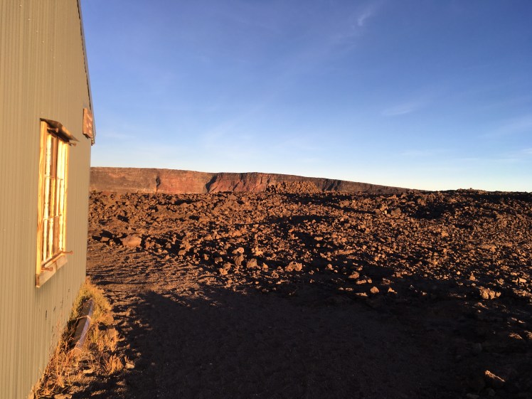
Mauna Loa Summit Cabin
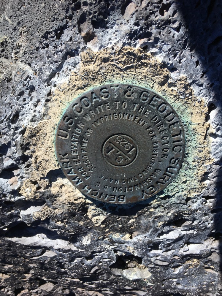
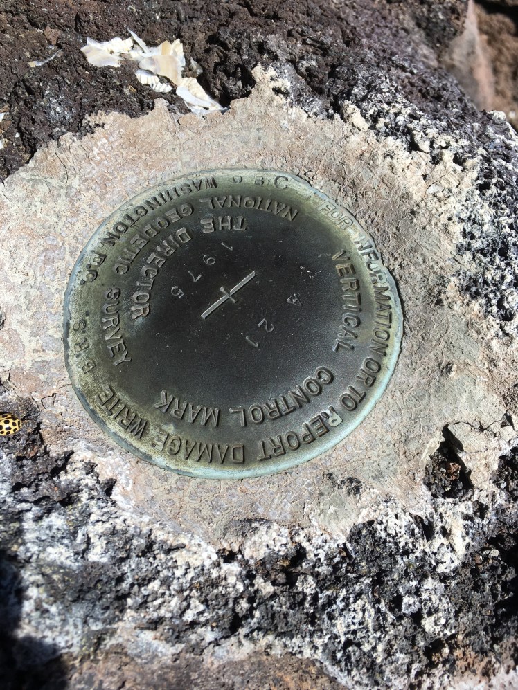
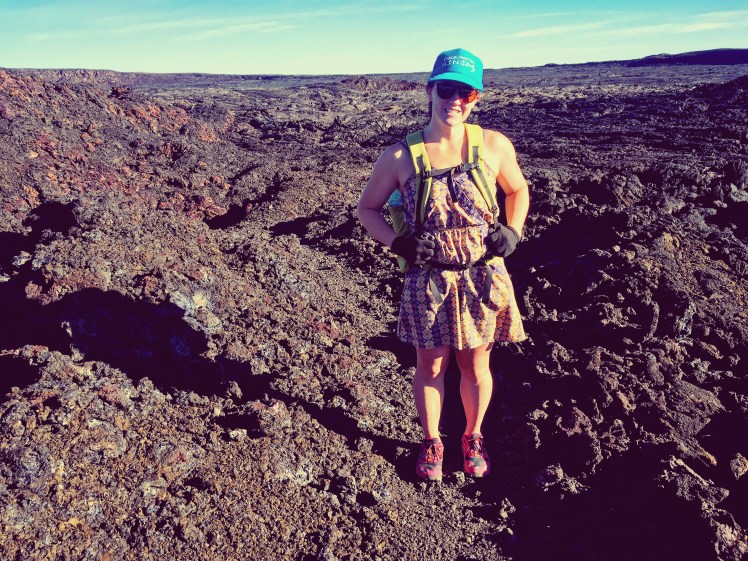
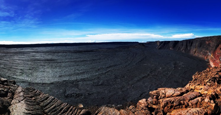
USGS markerTrekking on a’aMauna Loa crater.Mauna Kea summit proper. You can see the sign requesting people to respectfully go no further.Me with the true summit as the clouds rolled in.So many telescopes!Looking out from Keck Telescope
I drove out to Colorado Springs last night from my parents’ in Kansas, and am staying with my good friends Elise and Phil. So happy to have a moment to catch up! Elise and I go way back to our first adventures on San Salvador Island in the Bahamas during our undergrad time at Cornell College. I knew then that I had been missing her quirky humor in my life. We have been friends ever since. I was so excited to learn that she would have some time off this week for a hike!
Today we climbed up the beast of the Manitou Incline. This is a popular trail near Manitou Springs where people train for bigger and tougher trails and others take on for a proper butt-kicking. It is a 2000 foot climb for one mile on the old remains of the cog railway that went up to Manitou Mountain. Imagine large wood stairs wedged into the slope at an average grade of 45 degrees, and 68 degrees at its steepest. That is the Incline for a whole mile! It is no small feat.
Elise and I killed it up the Incline. About 2.5 hours round trip including all breaks and a snack stop at the top. My lungs felt great and my body felt pumped! Any nerves I had about hiking this week were settled after this little jaunt.
For anyone familiar with this trail, you know that the locals are passionate about this route. The last time I climbed it, in 2012, I met this 65 year old woman crushing it to the top. As I was talking with her and younger man came running, yes running, by. She said that was her son. Five days a week they would go out together. Her hiking once up while he would run up twice. And I would say that is not an uncommon activity. It is like the daily run around the park in other cities. There is literally the Incline 500 Club, whose members have to climb the Incline 500 times within 365 days to be a member, and there are about ten members. So I would be amiss if I didn’t give a little back history. The incline was built in 1907 as a water tram to carry water from the Pikes Peak side of the mountain over to Colorado Springs and Manitou Springs. A short while after that it was turned into a tourist attraction touting itself as the highest train in the world. After decades of erosion and a final washout destroying much of the tracks, it was closed in 1990. And that is when a small group of hikers began illegally climbing the trail. They called themselves the Incline Club, and the trail began to gain popularity. And that is when it really took off as a destination for adventure tourism. By the early 2010’s, there was so much regular traffic that the trail either needed to be made legal or actually shut down. Former President Barrack Obama signed the bill that legalized the Incline in 2013. And since then it has been going through a series of repairs. In 2014, new retaining walls and water culverts were installed. Then the Barr Trail was updated. The most recent update finished in December 2016, with newly installed rip-rap and updates to many of the old railroad ties and walkway “rails.”
Manitou Incline summary:
3.6 miles
2000 feet elevation gain
2.5 hours total
Elise and I spent the afternoon wandering around CO Springs after a well-deserved lunch. She talked wedding plans and then I hit the road. This was my first time, in memory at least, that I have driven over the Front Range on Hwy 24. It is a beautiful drive. And I had great views of Pikes and what I will see tomorrow.
I am camped at Crags Campground, just a skip up the road from the trailhead. I fixed up a cozy bed in the backseat, organized my gear for the morning, ate a delicious supper of cobb salad and maple-glazed donut, and then worked on my research for a bit. I arrived to the campground just as the sky started a gentle sprinkle. Since I am heading out so early in the morning, and driving over to Twin Lakes/Leadville tomorrow, I decided a backseat bed was the most efficient setup. There were several tents in the campground, but the light rain kept things quiet and nicely cooled the air after a hot mid-90’s day. I am comfortably lounging with my feet propped up and planning to attempt some shut-eye soon. It is difficult for me to sleep while still light out, but I hope that even just resting my body will help me feel rejuvenated in the morning.
I am so thankful to be back in this beautiful state. I have missed Colorado more than I realized. As Muir has brilliantly been quoted, “The mountains call to me, and I must go to them.” It will be with a heavy heart that I return to the coastal paradise of southern California. At least I have this glorious week to play in the mountains.
I will be heading to Kansas in early July to celebrate my father’s retirement. One week later I will be in Colorado to celebrate the wedding of my two friends, Becca and Evan. I am so excited to be present for both of these events. And the timing was perfect to afford me some extra time in Colorado to play in the mountains!
I have an ambitious plan for about five days that need to be split between adventures and research. Yes, that pesky PhD degree does still need my devotion. So my tentative agenda, weather permitting, is as follows:
Visit my good friends Elise and Phil in Colorado Springs. Then climb the Incline the next day with Elise as an easy acclimation hike. Let my body adjust to the time change and early wake up.
Camp at the base of Pikes Peak for an early summit of that fourteener the next morning. Hoping that despite the summer season, my week day hikes will remain relatively quiet!
Post up camping in the greater Leadville area. Summit Mount Elbert and South Elbert. Then take on Mount Massive, South Massive, Massive Green, and North Massive. And hit La Plata Peak on the last day.
Drive over to Grand Lake for the wedding celebration of the amazing Becca and Evan. Gather with good people, eat food, relax in the beautiful mountain town, and celebrate.
A final night in Boulder with Andrew and Emma, before flying back to California.
It will be an action-packed, whirlwind of a trip. But I am so excited for celebrations, catching up with friends, and getting outside!
If you are around and want to meet up, let me know! I won’t have a lot of free time, but am always down to have adventure partners to meet up with!
“An investment in knowledge always pays the best interest.”
-Benjamin Franklin
There is no time like the present to prepare for your financial future. I will not pretend to be a financial expert, and I know I make my own share of financial faux pas. But more and more I see ambitious young people setting themselves up poorly for the future. I am not a trust funder, no one handed me a golden ticket, and I am definitely not earning big money. But somehow I still manage to go places, do things, and travel frequently. My secret is to live as frugally as possible, save money starting at a young age, and never turn down an opportunity to earn extra cash. There are three main factors to think about: time, how much to save, and where to save it.
Time:
This is a really simple statistic that I think most financial investors try to get across to people. The more you put away and the sooner you put it away, the more money you will have later. This is the longest game. And it is the most rewarding game. Here is the simple math in three scenarios:
Michael is 35 years old. He starts saving $1,000 per year for the next 30 years at a 5% interest. He started with $0 in savings. At the age of 65, Michael will have deposited $30,000. Interest, however, will have earned off itself. So the account will have $72,053.64. That’s $42,053.64 of free money! Pretty nice.
Joanna is 25 years old. She starts saving $1,000 per year for 10 years only, then lets her account sit. Her money also grows at 5% compound interest and began at $0. At the age of 65, Joanna will have deposited $10,000. The account will have $60,576.05. That’s $50,576.05 of free money! Yes, Joanna’s account has $11,477.59 less in it, but she also contributed $20,000 less overall and made $8,522.41 more in interest. That means Joanna increased her earnings by $28,522.41 compared to Michael.
Kimie is a baby. Her parents set aside $50 per month until Kimie was 18 years old. At that time the account sat with no further additions. Kimie’s parents contributed $10,800. When Kimie turns 65, her account will have $182,946.54. That’s $172,146.54 in free money!
I think you can hopefully see the power of time and compound interest. The key here is to start saving today. Are you already 35 and haven’t saved anything? It’s ok. You will still be better off if you start putting away money now than if you wait. If you wait, you will have nothing.
How much to save:
The above example is great, but let’s think seriously about retirement. There are several factors involved. When do you want to retire? The legal age may go up, but that doesn’t mean you want to actually work that long. Let’s use 65 for this example. How much do you need to live each year? Let’s go with the idealized $30,000 per year. Though personally I think that is way too high. How many years will you need to support yourself for retirement? Another 20-30 years maybe? Let’s go with 95. At $30,000 per year, for 30 years, you need $900,000 in retirement savings. And that is only for one person. You may still have children to support during that time, big expenses to pay off, and unforeseen health expenses. So let’s add another $100,000 of cushion. Now, for some, this might not seem too unfeasible yet. But there is also the important detail of inflation. How will the cost of living change from now until you retire, and from when you retire to when you will die? Inflation goes up about 1.9% each year (based on averages since 1914). Based on current projections, if I live on $30,000 per year now at the age of 28, and I want to continue that lifestyle until I die at age 95, then I should expect to spend about $89,000 per year in 2053, and be spending about $218,000 per year by the time I die in 2083. I don’t know enough to do this math off the top of my brain, but that puts the required amount of savings required to actually support yourself in retirement at a significantly higher amount. I will ballpark at $4.4 million dollars! That begins to seem impossible even with savings. But would having a nice nest egg do any harm? I think not. And if you re-evaluate how much money you actually need each year, that amount can significantly come down. Not to mention that as I put money away now, that beautiful compound interest can help pad the rest.
So I won’t tell you what amount you should aim for. But you can check out this nifty Vanguard tool for your Retirement Income Calculator. Everyone’s needs are different. I try to save as much as I possibly can. It never hurts to have more money building that sweet sweet compound interest for you.
Where to save it:
I personally like to spread my money out in a few options. I have a Whole Life plan through New York Life. This is a life insurance plan coupled with retirement plan. I will not argue for nor against the higher rates I pay. That is the company I went with when I turned 23, and that is the company I will probably stay with. I also opened a Roth IRA and made regular monthly payments. I prefer Roth IRA’s and any investment plan that is post-tax money, because the amount I watch grow is the amount I will someday have all to myself. Though there are a lot of benefits to pre-tax money investment, I do not actually see the advantage. When I am older I can only assume I will be making more money and be earning off my smart investing, so I will be in a much higher tax bracket. That means that when I do finally withdrawal the Traditional IRA monies, they will also be taxed at that higher bracket. Whereas all the money I take post tax now, while I am poor and in a really low bracket, will not be taxed later. Both will be subject to the magic on compound interest, but in my mind the post-tax money will result in higher payouts longterm. When I worked for three years, my company had a 401(k) plan with matching. I obviously took advantage of that free money. And when I left that company in 2015 to come back to graduate school, I rolled over the account into a Traditional IRA. I could transfer that account into a Roth at some point, but for now I am happy where it is. I still make regular payments to my Roth IRA. And like any insurance, that also is paid on a monthly basis. But I view both of these accounts as “bills,” so I never really think about my building nest egg. I see it as money not available to me now, so it fleetingly leaves my psyche and I live within what remains.
Those are all retirement accounts though, and tied to being mostly inaccessible until reaching a certain age. I also have money in an S&P 500 account with Betterment (wikipedia link and personal link). (Disclaimer: For each person who signs up with Betterment through my personal link, I receive 30 days without service fees and you receive 90 days without service fees. If three people sign up, I will receive one year without service fees. This is not a special deal to me. I am not paid by, sponsored through, or receive any royalties from Betterment. This is a standard deal offered to all customers of the company. That is, they give a nice perk for free publicizing.) Since I have had a good experience so far, I am happy to publicize of my own volition. I found Betterment through the wisdom of Mr. Money Mustache, a financial blogger I occasionally pour over enviously as I near the age 30 and wonder why I am not about to retire… He has a lot to say about Betterment (MMM post here, with an update here), as well as the stock company, Vanguard (MMM post here). I could rave about how interesting I find this blog and rantings of Mr. Money Mustache, but I will let you come to your own opinion. I will correct myself here though (**literally an update 29 June 2017**), I actually found Betterment through a podcast I greatly enjoy: Planet Money. I have been listening to this podcast for the past couple years. And they advertise Betterment on almost every episode. But, unlike a blog, hearing information about a company sort of flows out the other side because I cannot visually see it. Another textbook example of how powerful website advertisement is! Anyways, the combination of reading about Betterment on Mr. Money Mustache and having that reinforced by Planet Money, I felt confident in researching the company seriously.
But I thought this was about financial advice to travel more!
I will add that I observe MMM’s advice pragmatically to fit my desires of travel. It is never too late to save for retirement, but I also spoon off some of the fatty cream to finance my travels. The concepts are the same. I will not retire at 30 because of my meager student income savings, and the fact that 50% of those savings go directly into my travel fund. But that is the lifestyle I require to function happily. I also seek out opportunities for travel where some or all of the cost is covered. Though this will typically result in me not having a choice in where my vacation takes place. But isn’t all travel worth it? I think so!
Ways to have your travel paid for:
Work in the outdoors or in a high travel field or abroad: National Park System, land surveyor, landscape architect, archaeology crews, pest management technician, termite technician, environmental scientist, construction mason, outdoor instructor, camp recreation, trail crew, au pair, English/ESL teacher in foreign countries, wildlife management, nature photographer, National Geographic Explorer, island caretaker, park ranger, forest firefighter, guiding, freelance writer/photographer, travel agent, tour guide, travel nurse/doctor, WWOOFing, flight attendant, airline ready reserve agent, pilot, missionary, diplomat, importer/exporter, Peace Corps volunteer, Busker, cruise ship gigs, yacht sailor, Navy sailor, yoga instructor, and the list goes on. You can even look for non-outdoor employment abroad.
Become a professional adventurer/traveler/explorer. This is not very realistic. But if you think it is for you. Do your research and get out there. The pros are experts at what they do.
Look for unique volunteer positions that can lead to paid positions and resume bolstering. For example, if you know a camp that needs a cook. Volunteer to cook for free. If they like you, they may hire you back. The better option is to find a program through a university, school, church, that takes people/children out on trips. They often pay meager sums, but cover all your expenses. If you do a good job, you are more likely to be invited back, as well as word of mouth for other more exciting opportunities. I used cooking as an example, but this also works for guiding/trip leaders, musicians, travel companions, and others.
Odd jobs to earn extra cash: lawn maintenance, Airbnb, Uber/Lyft, Turo, ToursByLocals, general labor, personal assistant, house cleaning, pet sitting, child sitting, house sitting, errand runner, personal shopper, yoga instructor. My tip is to never turn down an odd job. They are a great reference for future opportunities.
Feel free to comment below for other opportunities, advice, or suggestions!
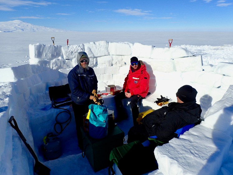
A couple weeks ago was the APECS International Polar Week conference (link here), and I submitted two photos to the Photo Contest Spring 2017. Turns out I won first prize in the “PolarPeople at home” category.
Caption: Ross Sea Ice Shelf, Antarctica, 1 November 2016. “Enjoying a snack break and rest after cutting ice blocks to build the kitchen walls. Antarctic home life.”
——–
My other photo was in the “PolarPeople in action” category:
Caption: Lillie Hills, Antarctica, 8 December 2016. “Mesmerizing view while hiking up a mountain during geology fieldwork.”
This morning I took my bicycle to a bike shop. I bent my derailer and apparently have been causing the slow demise to my shifters myself. Somehow I hadn’t caught on that my bottle cage and front gears were competing for the same space. The shifters were in the lead to begin with but the bottle cage won the long game. Overall pretty easy fixes. The problem was that I am out of time. I could possibly have put myself into super gear and powered to Christchurch. But it felt right to stop. And truly the cosmos was backing that decision. As if on cue, heavy rains started in Dunedin shortly after finishing up at the bike shop. I booked another night at On Top Backpackers, stowed my things in the storage closet, and spent the day on foot seeing the city.
It was a relaxing day. I walked around the Dunedin Chinese Garden. I seriously want a traditional Chinese garden inspired space someday. Then I wandered around the Toitu Otago Settlers Museum, which is completely free and well worth the look around. It ranged from the early indigenous cultures through the arrival of European peoples, and then New Zealand modern history through the 1900’s with a special exhibit on the famous Dunedin Multidisciplinary Health and Development Study, or Dunedin Longitudinal Study, where 1037 people born in 1972-73 were studied at certain age intervals. The study continues. These people are brought back to Dunedin periodically to be assessed in a number of categories from health, lifestyles, behaviours, and attitudes. Really neat to see.
I wandered around the city and relaxed the rest of the day. After loitering too long at a pizza pub for supper (to use their free internet!), I went to the movies! I can’t remember when I went to the movies last. I saw La La Land, starring Emma Stone and Ryan Gosling. So good! I already love musicals, they are not a dying pleasure in my life, but I think even the non-musical addict can enjoy this film. It definitely brings me back to my childhood dream of being a triple threat: singer, dancer, actress. Back at the hostel I was ready for an early night in to catch my early bus the next morning. While enjoying a tea before bed, I had the great fortune to chat with Peter Gazzard. He is from South Africa and is currently a couple years into cycling around the world! Check him out on Facebook (Gazzie on Tour) and if you are feeling generous, consider donating to his cause (http://www.givengain.com/a/pedallingpete/). He is cycling to support the Qhubeka initiative in raising money to provide bicycles for the needy children in South Africa. A very interesting and kind man.
Early the next morning I went to the Taieri Gorge Railway. This is where I caught the bus to Oamaru. The rains hadn’t let up yet. In fact they continued all the way to Oamaru. My plan had been to spend the day venturing around Oamaru before catching an evening bus the rest of the way to Christchurch. Due to the heavy rain, I did not wander around too much.
The bus that evening took me into Christchurch. I stayed with an AirBnb and had a really nice sleep. It was a hard sleep, just a good sleep, and long. I woke up feeling like I hadn’t slept that well in a long time. The day was rainy but I spent most of it inside catching up on posts and emails. I retrieved my baggage from the CDC, took apart my bike, and packed up for the long flights back.
This trip is finally over. Glad I had the opportunity to explore a place so different as Antarctica. And I am thankful I was able to spend time riding my bike around New Zealand.
I woke up last night, not sure if by the rustling noise outside or my need to pee, but I woke up all the same. I thought someone must have shown up after I went to bed and set up their tent by mine. Needing to pee, I had no choice but get out of bed. As I crawled out, my light shining ahead, I saw the fat back end of a sea lion! It was rousting about in the bushes by my tent. As it waddled off I wasn’t sure if I was concerned or amused.
It was a lucky thing that I woke in the night because I was next roused awake around 5:30AM by the start of a downpour. Briefly followed by the start of some intense wind. I was able to sleep in until 9AM when there was a brief sunny spell. I packed up and briefly chatted with the family at the camp while I dried out my tent. I finished stuffing my tent into pack just as a new spell of rain began. It rained on and off the whole day.
Since the weather was relentless, I knew my agenda was to merely hike to Bungaree Hut. I tried to take my time. I stopped at Port William Hut and checked out the wharf. I hiked really slow, which wasn’t a challenge since the rain turned the trail into a massive slippery mud path. I have never felt more childlike than tiptoeing through a multi-kilometer mud puddle, trying not to get my feet wet or muddy. The inevitable eventually happened, and both feet were soaked in wet, sloshy mud. Then all bets were off and I had mud up my legs by the time I arrived to the hut. In all honesty, it was almost dangerous. The mud was so incredibly slippery. There are parts where the route takes you straight up a tree root series. In dry conditions that would mean about forty feet of climbing up through thick roots, making pseudo-steps up from dirt-filled crevice to dirt-filled crevice. In the rain it was more like a vertical slip-n-slide with mud and hard plant parts. The result of which was me grabbing desperately at roots to pull myself up, my feet slipping everywhere, and my knees in the muddy slope. The down sections were the scariest though. It is easy to get up a muddy surface, eventually. But safely down a muddy section is not as easy or sure-footed. Not enough to dissuade my excitement to be out hiking though!
Despite the muddy travel, I arrived around 2PM to Bungaree Hut. On my arrival a man walked out of the hut, excited to see me. No, we did not know each other. About halfway back on the trail he had dropped his bag of steak. I had picked it up and was carrying it in my hand as I walked up. He and his wife were delighted that I had saved their fancy meal. This is their 9th wedding anniversary hike on the North West Curcuit. I chatted with them awhile. They were very nice.
After I had eaten, rested, and dried off, I decided it was a good time to go wash up. I went out on the beach and washed my socks and shoes. I have never seen so much mud come out of my Altra shoes. With the rain still coming in patches I suspect my clothes will be wet still tomorrow.
The hut is full tonight. 16 bunk spaces. I am amazed by this posh hiking setup on Stewart Island. The trail system is set up so you can hike hut to hut. The distances between are anywhere from 8-16 km. I was told that the North West Curcuit isn’t maintained like the Rakiura Track, so the distances are short but harder. I thought the trail was fairly challenging to Bungaree, but I still arrived just under the faster end of the expected travel time. I will admit that compared to the hikers I saw, I am traveling incredibly light. The ranger woman saw my pack and thought I was a dayhiker. For traveling such short distances to sleep at a hut where clean rain water is available, I don’t know how I could have packed more. I am always amazed by how large of packs I see out hiking, but I was particularly surprised here. If I had realized how short my days were going to be, I would have booked further sites. C’est la vie!
Moving on, the huts are incredible. The two huts on the Rakiura are bigger and fancier and have a person stationed at them. Bungaree Hut is considered a standard hut, unmanned, 16 bunks, sink and kitchen counter, table and benches, drying lines, and picnic table outside. Then there are also hunter huts, which are supposed to be more basic. When I thought about what the huts would be like, I imagined barren wood huts similar to those I have seen on US trails. Usually drafty, likely rodent-inhabited, open-floor planned, vacant building for floor sleeping. These are not that. They are quite nice. I would genuinely leave my tent behind if I knew I could stay in a hut each night. Technically, you wouldn’t even need a ground mat. The bunks have mattresses. Though you might risk a night on the floor if you happen on a really full hut. The downside of course being that you are with people, so no privacy. It was pretty nice though. They even have fire stoves and open-sided sheds to dry wood for fires. A ranger at the DOC visitor center told me that all the Stewart Island huts are deep cleaned once a year. And people like Carol, the Port William attendant, travels between the first few huts on this side of the island to check on general hut conditions throughout the season.